Problem
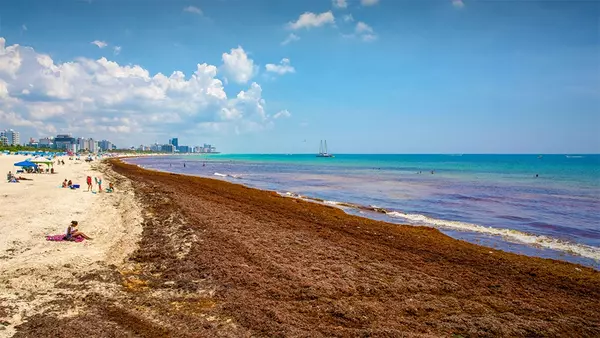
Since 2011, there have been a critical increase of Sargassum mats beaching across the Caribbean. It is a new form of coastal hazard and has direct impact on the economy, the water quality and the nearshore ecosystem. Challenging for local and regional authorities, as well as scientists, and increasingly becoming a nuisance to beach goers and residents’ quality of life (Langin, 2018), the monitoring and the forecasting Sargassum paths requires to be addressed urgently to provide sufficient warning to coastal communities.
 Photo from Michael Montero/UM News of South Beach on Miami Beach on June 21, 2018.
Development
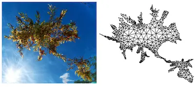
We are currently developing a drift model for Sargassum mats that can be used to generate realtime forecast of beaching probabilities from satellite-inderred offshore locations. The transport model is based on the inertial equation (Beron et al, 2019). In Beron & Miron 2020, we model the Sargassum raft, which are formed of gas-filled bladders connected by flexible stems, as a network of elastically interacting inertial particles. Those elastic connections are important for the drifts of the algea and are critical to improve the forecasts accuracy.

Applications
We are currently looking for funding to pursue the development of a Sargassum transport model and to develop a real-time Sargassum mats forecast system. Using fully-coupled ocean model forecast output, the goal would be to generate probabilistic maps of algae beachings.
Sources and publications
- K. Langin, Seaweed masses assault Caribbean islands, Science, 2018, link
- F.J. Beron-Vera and P. Miron, A minimal Maxey–Riley model for the drift of Sargassum rafts, Journal of Fluid Mechanics, 2020, link
- F.J. Beron-Vera, M.J. Olascoaga and P. Miron, Building a Maxey–Riley framework for surface ocean inertial, Physics of Fluids, 2019, link